
So, What's Math Good For, Anyway?
How People Use Math in Their Work
by
Book Cover & Preview Text
SATELLITE COMMUNICATIONS In another job, Evans worked on satellite communications. Satellites can be classified by the type of orbit in which they travel around the Earth. A satellite in “geostationary orbit” (GEO), as shown in Illustration 160, sits about 22,000 miles above the Earth’s equator and orbits at the same speed as the Earth turns, so that it appears from a location on the Earth’s surface that the satellite is fixed in one position directly above. GEO’s are often used for telecommunications (including TV and internet), monitoring of long-term climate changes, and weather tracking for the area directly below the satellite on Earth’s surface (including for hurricane, tornado and other storm warnings). The other type of satellite shown in Illustration 160 is in "low Earth orbit” (LEO). The International Space Station (ISS) and the Hubble Telescope are examples of this type of satellite. They are much closer to Earth than a geostationary satellite, and they appear to be in motion from the point of view of an observer on Earth. For example, there are times when people on Earth can look up and see the ISS moving across the sky. Illustration 160 Illustration 160 is a simplified model of these types of orbits, because although geostationary orbits are always over the Equator (since the satellites need to orbit at the same rate as Earth’s rotation), satellites in low-Earth orbit can travel at various inclinations. While the diagram shows the path of only one “low Earth orbit,” there are low-Earth satellites in polar orbits (that pass over or near the North and South poles), equatorial orbits (around the Equator) and inclined orbits (at angles to the Equator). Evans worked on geostationary satellites. Some geostationary satellites relay television signals, that is, programs that people will watch on their TV, laptop, or other devices. Illustration 161 In Illustration 161, two transmitting/receiving stations are out of range for a direct signal from station A to station B because of the curvature of the Earth. If Station A wants to send TV programs to Station B, the signals containing the programming are sent along the uplink to the satellite, which then sends the signals along the downlink to Station B. If you have read Chapter 22, you have already seen a diagram similar to this one while learning about how a team of engineers designs, builds, and tests satellites. In this chapter, you’ll learn about signal intensity between Earth and a satellite. One of the concerns of an electrical engineer working on sending transmissions to satellites (like the TV shows we're talking about here) is that the farther a signal has to travel, the more intensity is lost from the signal, and there is a mathematical expression that describes this phenomenon. The loss of signal intensity "varies as 1 divided by the square of the distance." For example, first, assume that the intensity of the signal for 1 mile of the trip to the satellite is known; then if we consider a distance of 2 miles of the trip to the satellite (twice as far), the intensity of the signal would be 1/(22) or 1/4 of the intensity for the signal travelling 1 mile. If we look at a distance of 3 miles, the intensity of the signal would be 1/(32) or 1/9. Recognizing the pattern, it becomes clear that a signal travelling thousands of miles will lose a lot of intensity. Perhaps certain signals may not make it all the way to the satellite, or even if they do, they might be too weak to accurately convey the information that they carry. So to solve this problem, electrical engineers have ways to amplify (increase the intensity of) the signal, both here on the ground at a transmitting station before the trip to the satellite, and on the satellite itself, for the trip back down to Earth. But the engineers need the distance from the Earth to the satellite, in order to figure out how strong the signal has to be to go all that way, or to be amplified to make sure it arrives. There is a straightforward method for calculating how far the satellite is above the Earth. The method relies upon the fact that radio waves travel at the speed of light, 186,000 miles per second. Here are the steps: The engineers start a precise clock and simultaneously send a brief pulse of radio waves toward the satellite. Using their instruments, they watch for reflected radio waves that have bounced off the satellite and returned to Earth. They note the time on the clock (in seconds) at which the radio waves arrived back on Earth. Using the formula Distance = Rate x Time, they multiply the time (in seconds) times the rate of the radio waves to find the round-trip distance that the signal travelled. Then they divide the round-trip distance by 2 in order to determine the distance to the satellite. Let’s say the clock measured 0.24 seconds for the time up to the satellite and back to Earth. Distance = Rate x Time Round trip distance = 186,000 miles x 0.24 seconds 1 second Round trip distance = 44,640 miles Distance to satellite = 44,640 ÷ 2 = 22,320 miles Once the distance to the satellite is calculated, the engineers can determine by using additional mathematics if the signal they are planning to send will be strong enough to reach the satellite or if it will have to be amplified. This has given you just a small peek at the math involved in hydraulics and in satellite communications. Engineers will be working on scores of applications in both of these areas, and others, in the next decade. Maybe you will be interested in studying the math and science needed for work as an engineer! I want to thank Evans for the time he spent explaining his interesting career path!
Select Format

Book Details
About the Book
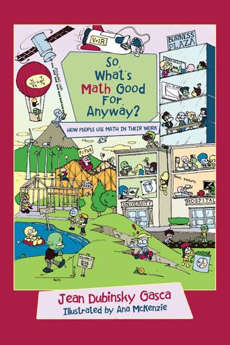
Jean Dubinsky Gasca’s math students often asked, “How will I ever use this?” In reality, many people use math in their work, and if students have math in their toolbox of skills, that might open a door for them later on. So, What’s Math Good for, Anyway? is an engaging and informative book exploring the practical applications of math in myriad real-life fields. Jean interviewed twenty-five professionals, ranging in careers from science and medicine to architecture and business administration, and even within creative fields such as visual effects and photography. Through stories about their work, students will learn the value of math and the amazing ways it is used in all aspects of life. The book is written in an easy-to-understand style and is illustrated with delightful drawings. It is designed for readers from twelve to one-hundred-and-twelve! Regardless of whether you find math challenging, you wrestle with math anxiety, or you are one of those to whom math comes easily, you will enjoy these glimpses into how math is used in the work that people do!
About the Author
Jean Dubinsky Gasca worked as the lab assistant for the UCLA Parasitology Lab during her undergraduate years in Biology. This was followed by her study of probability and statistics for her master’s degree in Engineering Systems. She taught “Patterns of Problem Solving” as a Lecturer in UCLA’s Engineering School for several years and then worked for an engineering consulting firm as a computer programmer. During the next twenty-five years, she taught math and science in 3rd through 10th grade classrooms. Since retiring from full-time teaching, as a tutor she has helped students from kindergarten through college to be more successful in, and even enjoy, math!